About this course
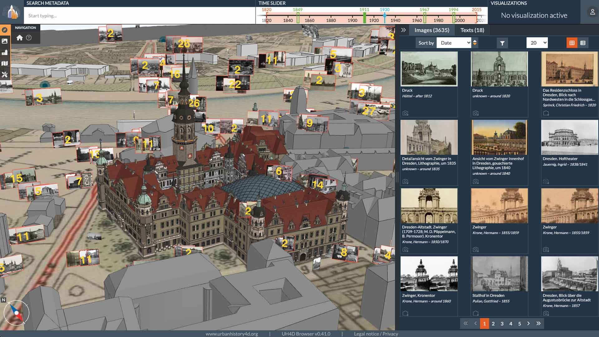
This course is designed to introduce new users to the 4D Browser - developed by the UrbanHistory4D project - an innovative tool that lets you explore historically reconstructed 3D cityscapes across time. By combining spatial and temporal data, the 4D Browser enables immersive virtual tours through the evolving urban landscapes of cities like Dresden, Jena, Budapest, and Amsterdam, using authentic historical photographs precisely placed within a digital 3D model.
Whether you're a history enthusiast, educator, researcher, urban planner, or simply curious about how cities transform, this course will help you harness the power of this unique browser to visualize and interpret the past.
The course was developed as part of the 3DBigDataSpace project, which aims to increase high-quality 3D content in the common European data space for cultural heritage and establish Europe-wide, stable, long-term storage solutions for 3D models.
Who is this course for?
- First-time users of the 4D Browser;
- Students and teachers in history, architecture, or digital humanities;
- Researchers interested in historical GIS, visual culture, or urban development;
- City residents and tourists eager to explore cultural heritage;
- Archivists and curators seeking new ways to present historical collections.
No prior experience with 3D software is required. If you can use a web browser and a mouse, you’re ready to go.
What you’ll learn
By the end of this course, you will be able to:
- understand the core features and functions of the 4D Browser;
- navigate and interact with 3D city models;
- access and analyze georeferenced historical photos;
- use the time slider feature to explore urban transformation.